Wednesday 28 February 2018

Karitane


Karitane, a small seaside village about 30 mins north of Dunedin, lies at the mouth of the Waikouaiti River.

A tribute to Sir Fredric Truby King who founded Plunket and Karitane Hospitals. Sir Truby owned a holiday home here in Karitane.

More photos of the Karitane area.


On the eastern side of Kaitane is the Huriawa Peninsula. Once a pa site, it is now a historic reserve. There are tracks all over the peninsula and some magnificent views. Entry is free, but there is a place when you can give a koha (donation) towards the upkeep of the reserve. Dogs are allowed here on leads.

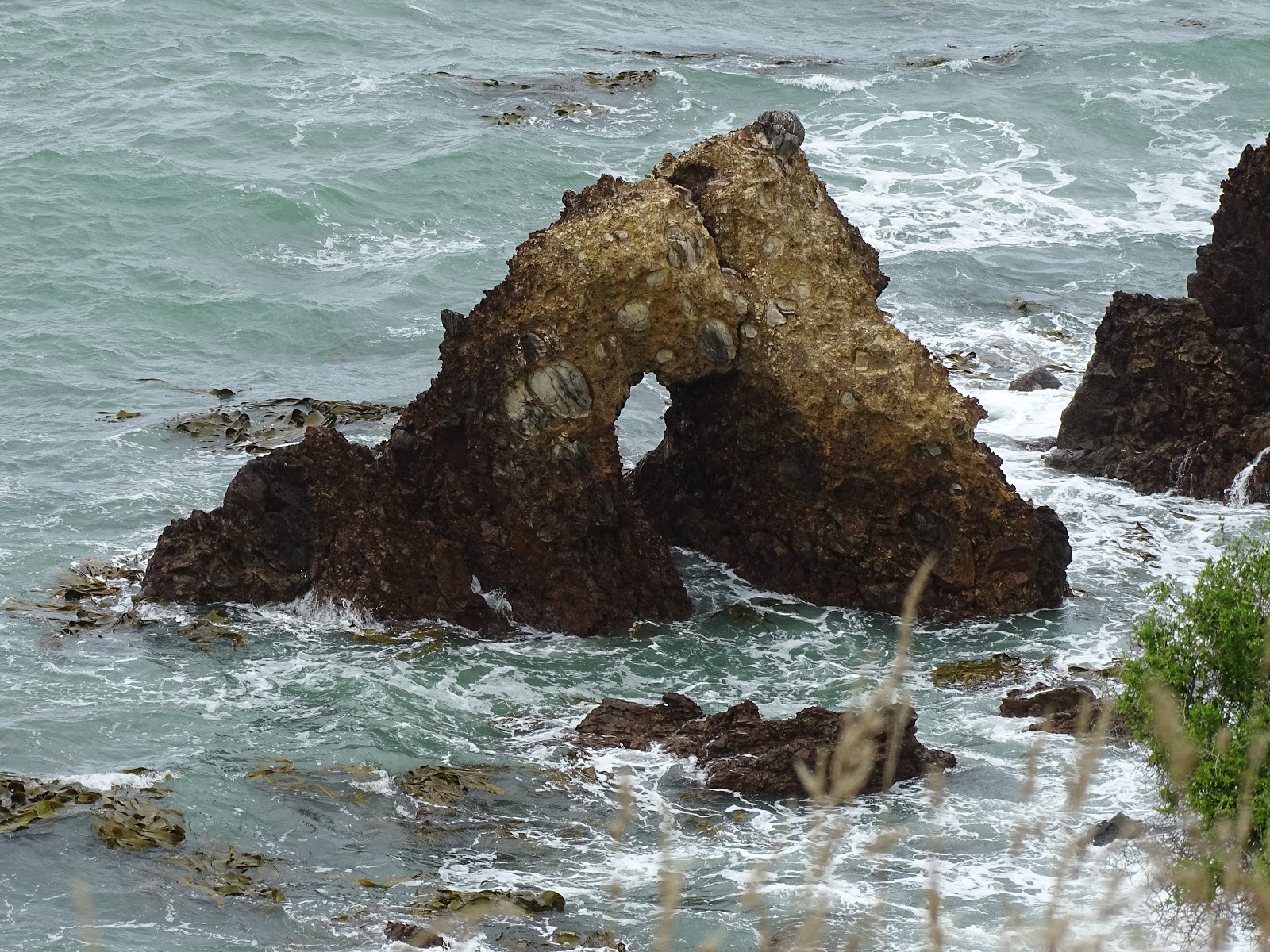
This rock with a hole in it is on the southern side.

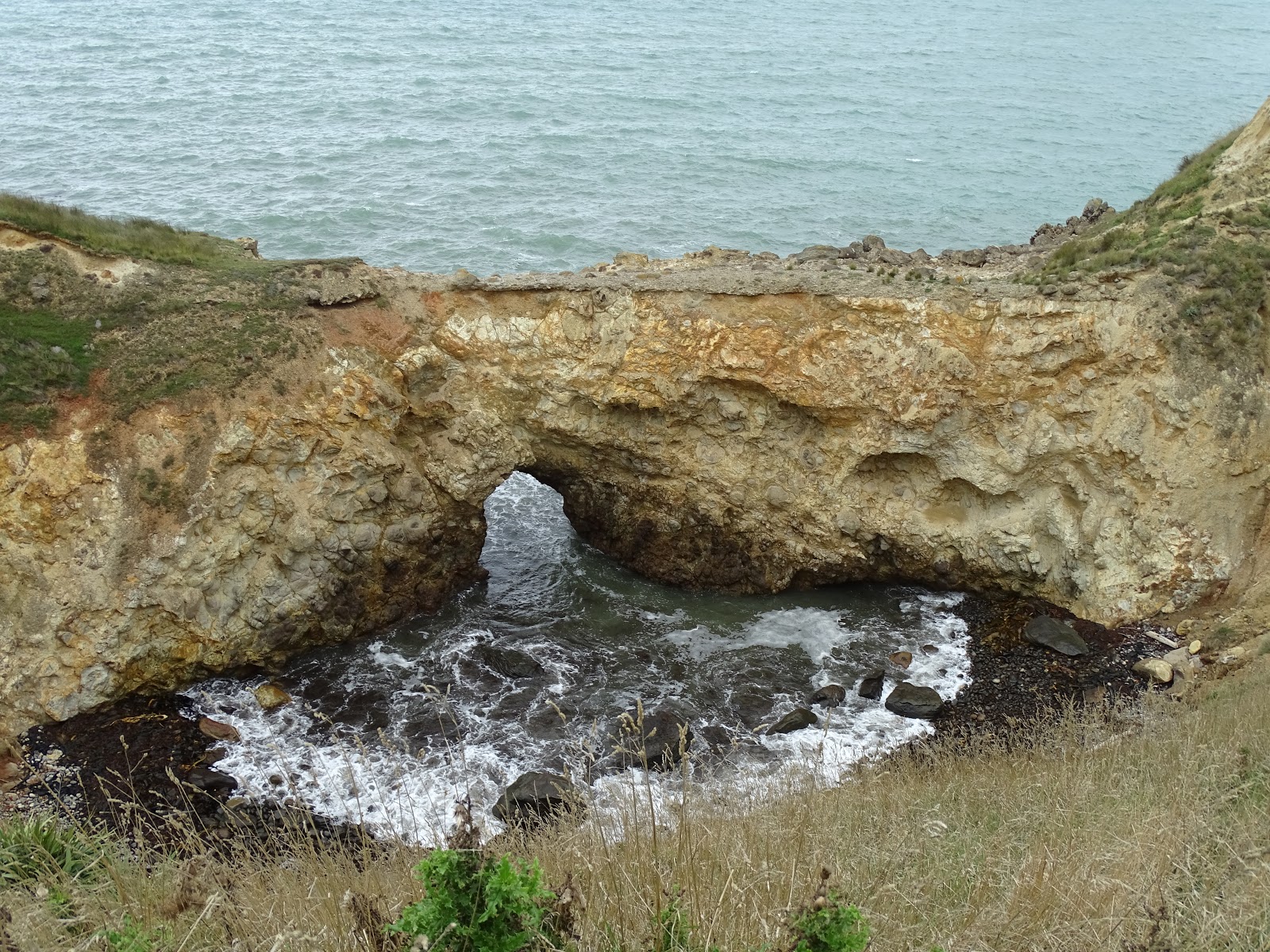
Again on the southern side, a place where the sea pours through a gap into a small area.

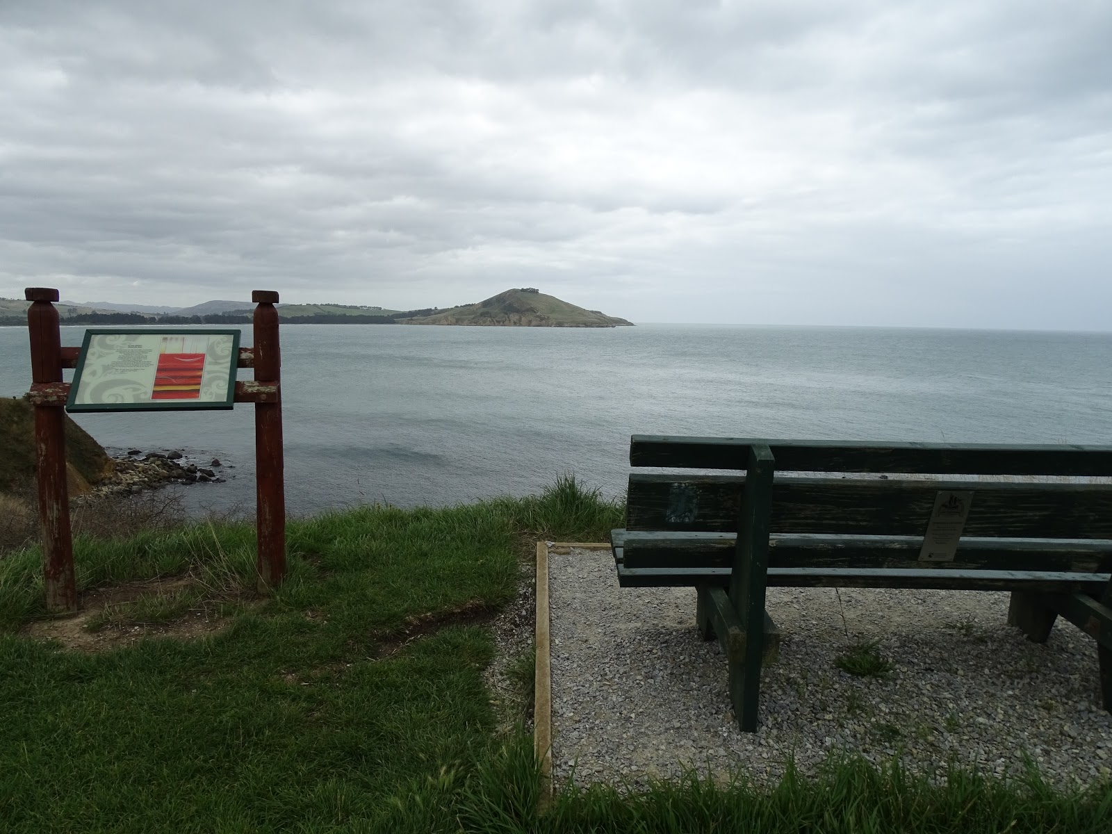
At different spots along the track are signs similar to this, telling Maori stories of the area.

Another interesting area created by the constant erosion of the sea.

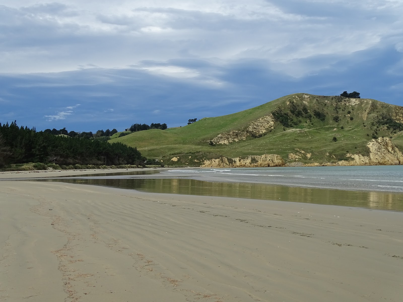
Looking out across the Bay towards Waikouaiti Beach and Cornish Head.

Looking towards the end of the peninsula . . .

There came a point where we could go no further.

There were several traps set in the area, clearly marked "Do Not Touch". (See bottom right photo.)

The northern side.


The tracks are not signpostedyou can wander at will. When we arrived back near the entrance, we decided to head off down another track, heading south. If we hadn't, we would have missed a close-up view of these magnificent rock formations.

The inside of the fence at the entrance to the reserve.

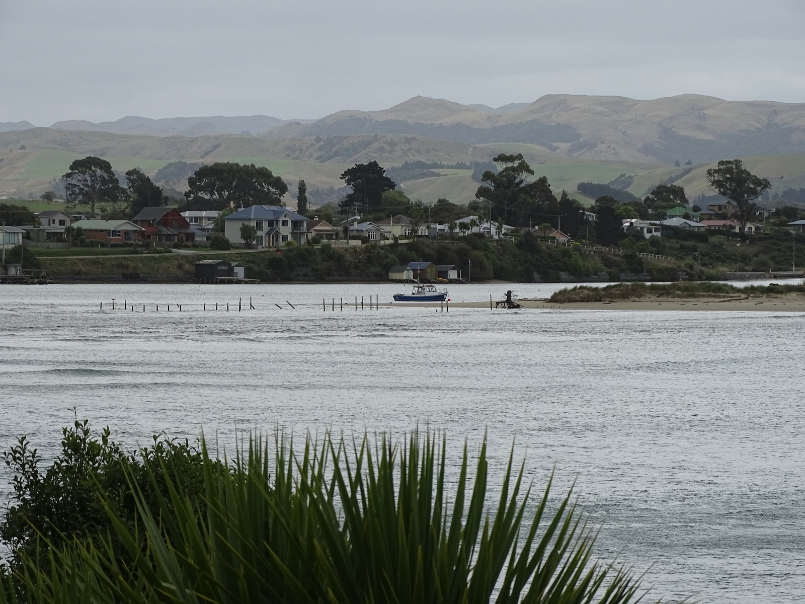
Looking back at Karitane. This is the Huriawa Peninsula in the centre right of the photo and Waikouaiti beyond in the distance.

A closer view . . .

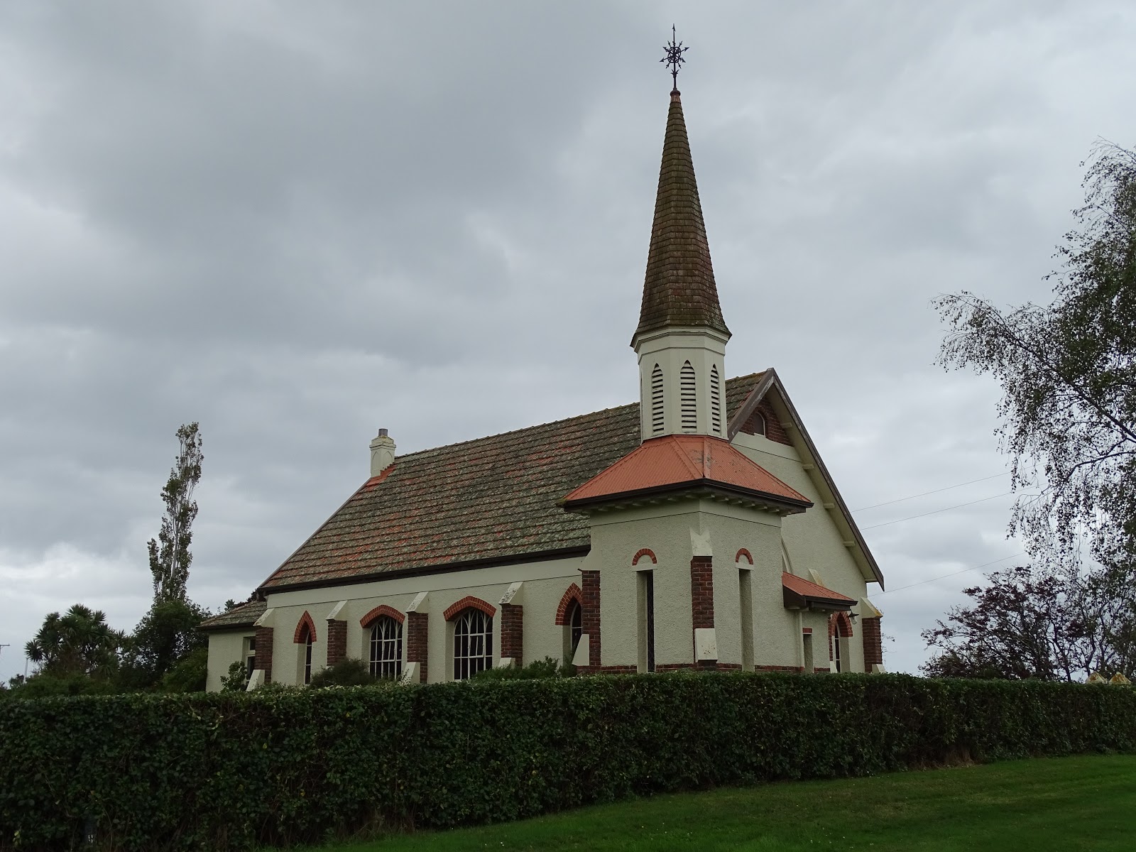
This former Roman Catholic Church at Seacliff has been restored and converted to a home. Seacliff is another small town south of Karitane.


If you cannot see "Post a Comment" below, click here (and scroll down to the bottom of the post) to talk to me!


Tuesday 27 February 2018

Waikouaiti Beach


Waikouaiti Beach has a Holiday Park that also functions as a POP (Park Over Property), meaning that NZMCA members can stay there for free and not use the camp facilities. Or . . . use the facilities (no power) and leave a donation.

Just a short walk from the camp is Waikouaiti Beach. Horses exercise along this beachthese ones were just leaving as we arrived.

Dogs are allowed off lead as long as there's no wildlife around (e.g., seals) and they're not bothering nesting birds.

Waikouaiti Beach has beautiful white sand.


This gull was flying up high and dropping its shellfish onto the sand to break it open. I was thinking it wasn't going that high and the beach wasn't really a hard surface to drop it onto . . . but it worked, and he reaped his reward.

Near the north end of the beach, there was what appeared to be a river meeting the sea, but Google maps show no river therejust what looks like a small inlet. I was a little surprised.

It was flowing water, and too deep for Lucy to want to cross. Dave waded through and it was only up to his shins. However, it was a cold day, and I was not dressed for wading through even shallow water. So we didn't venture any further in that direction.

The beach has a wide strip of pine trees along the shore. You can drive through them a short way, but the road stops at the inlet.


If you cannot see "Post a Comment" below, click here (and scroll down to the bottom of the post) to talk to me!


Monday 26 February 2018

Waihao Box


Waihao Box is located east of Waimate, at the mouth of the Waihao River. There's a camping spot here where we stayed for a couple of nights.

You can see there's been a significant amount of rain in the previous few days.

There is no sand on the beach. Instead, large flat stones stretching into the distance . . .

. . . in both directions. It was like standing on a dune of shingle.

Nearby, the river mouth. On this side, a flock of terns sitting on the stones, and on the far side, you can see shags.


Lucy didn't enjoy the stones. They were probably not that easy for her to walk on.

Here she iswaiting for me to come back.

On the first night, she found a friendMix. Mix loves to retrieve sticks and is very much at home in the water. This is about as deep as Lucy will go. She waited for Mix to bring the stick back in, but then she wouldn't let her bring it any further!

This is Mix's owner, Dave, on the right talking with Herman, another camper who arrived shortly after we did. Dave stays permanently in a caravan on a neighbouring farm. An interesting manwe enjoyed hearing about his life and the area.

There were a lot of shags around, and most of them weren't that frightened of us. Dave told us many of the juvenile shags were rather lethargic and had been dying, but he wasn't sure why.


A signs tells how the box was built in 1910, replacing a previous one built in 1896 about 2 kms further north. There is no permanent river mouth for the Waihao catchment. The box structure prevents the shingle barrier completely blocking the Waihao River, thus assisting with drainage and reducing the risk of flooding.

"Water can flow through the box, but what is especially ingenious about it is that the north-facing side of the box is open so that when flows are especially heavy, pressure builds up in the box so that water is then forced out the open side thus speeding up erosion of the gravels alongside it. These then scour away creating a channel from the lagoon to the sea. There's a 'nose' at the sea-side end that helps prevent the sea washing into the box (and thus stopping river water flowing out).

"It is believed that the Waihao Box is the only functioning one of its kind in New Zealand and possibly in the world. There were once two on Saltwater Creek near Timaru (one of which was still working until the 1970s) and one on Horseshoe Bend Creek (also in the Waimate District). Further afield there was thought to have once been a box on Lake Ellesmere near Christchurch and possibly two somewhere in the North Island."
(Source: http://www.scoop.co.nz/stories/AK1011/S00623/the-waihao-box-celebrates-centenary.htm - you can read more at this link.)

Where the river goes out to the sea (and Dave fishing).

Views of the box. Much of it is covered in shingle.


There are warnings about how the shingle moves and can be dangerous. 

This shingle on the far side of the river mouth was falling away into the sea as I took this photo. Notice where the stones are slightly darker (freshly exposed to the sun, wet with water running through them). Although the shags appear unconcerned, I doubt it would be a good place to be standing for too much longer!

A monument was erected in 2010 to commemorate 100 years since the Box was built.

And a sombre reminder of how dangerous the moving gravel can be.


If you cannot see "Post a Comment" below, click here (and scroll down to the bottom of the post) to talk to me!