Saturday, 27 January 2018

Cape Palliser


It was a really hot day when we decided to drive out to Cape Palliser. On the way, we passed through a small township on the coastNgawi.

This is where old bulldozers enjoy their retirementtowing boats to and from the sea.

A little further on, and . . . seals! There were about ten NZ fur seals, most of them just sleeping in the sun.

This one apparently had an itch it couldn't quite reach!


And this one had just come out from a cooling dip in the sea.

Eventually, we reached the Cape Palliser lighthouse, which is really the end of the road. Cape Palliser is the southernmost point of the North Island. It is even further south than Nelson or Blenheim in the South Island.

Contemplating the lighthouse. All those steps! 253 of them.

Fortunately, the steps were nice and deep, and each one was not too high, which made the climb a little easier.

Almost there . . .

And finally, at the top. I think I must have lost a bit of fitness over the past few weeksI had to sit in the shade for a while to catch my breath! It wasn't quite as long a climb as up to the East Cape Lighthouse, but it still got the heart pounding. Maybe I could blame the heat. I was wishing I'd brought my water bottle.

The lighthouse was built in 1897 and it's 18 metres high.

At the top, the view back down the way we'd come . . .

. . . and on the other side, the car park and the end of the road.

Time to go back down again.

I took some photos of the road on the way back to Ngawi. It was unsealed and narrow in places

Then we noticed this amazing rock formation. The layers of rock jut right up into the sky.

This photo below (the same as earlierthis time look at the rocks and not the seals) shows the left side of the roadleft of this huge rock formation above. The hills on the far left of the photos above are the same hills to the right of the photo below. It seems to be a ridge that comes out of the sea (the campers are parked on it) and then up to the sky. The road drives right over it.

More narrow roads . . .

. . . and then a sharp corner with water running over the road.

We took a detour to visit Lake Ferry on the way back to the rig. Lake Ferry is not an actual lake, but a small village on the shores of Lake Onoke.

Lake Onoke opens out into Palliser Bay.

We'd heard the fish and chips here at the Lake Ferry Hotel were legendary, but there was a classic car club event and lots of hungry people. The line to get into the hotel was barely moving, so we decided to move on to Martinborough.

The cars at Lake Ferry were fabulous. A huge variety and obviously much loved.


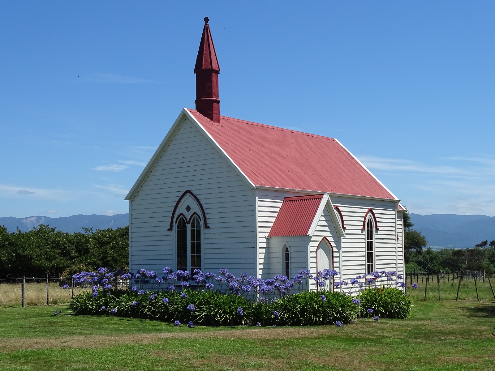
While heading towards Martinborough looking for lunch, when we came across this lovely old church.

Martinborough Hotel . . . and a delicious lunch. It was 31 degrees, and even in the shade it felt hot.

I forced myself out into the heat and across the road to get this shot of the hotel. Isn't it beautiful?

If you cannot see "Post a Comment" below, click here (and scroll down to the bottom of the post) to talk to me!

Thursday, 25 January 2018

Castlepoint


What a fabulous beach! Very popularthere were a lot of people here the day we visited, and there's something for everyone. Surfing (although not high waves this day), fishing, canoeing, walking and swimming.

Castlepoint is about an hour east of Masterton. The first day we decided to come here, we ended up in a long line of about fifty cars behind a bike race, so we decided to turn around and visit Castlepoint the following day.

It's mainly sheep country in this area with a few beef cattle. As you get closer to the coast, there are some small forestry blocks. Then Castlepoint. A lovely beach townvery busy on the day we were here. The car parks are quite small, but there's plenty of space to park right down on the beach.

There are some massive boats parked up on the beach as well and some monster tractors that tow them!


Castlepoint has two main beaches: one is a surf beach and the other is a lagoon. This is the surf side:


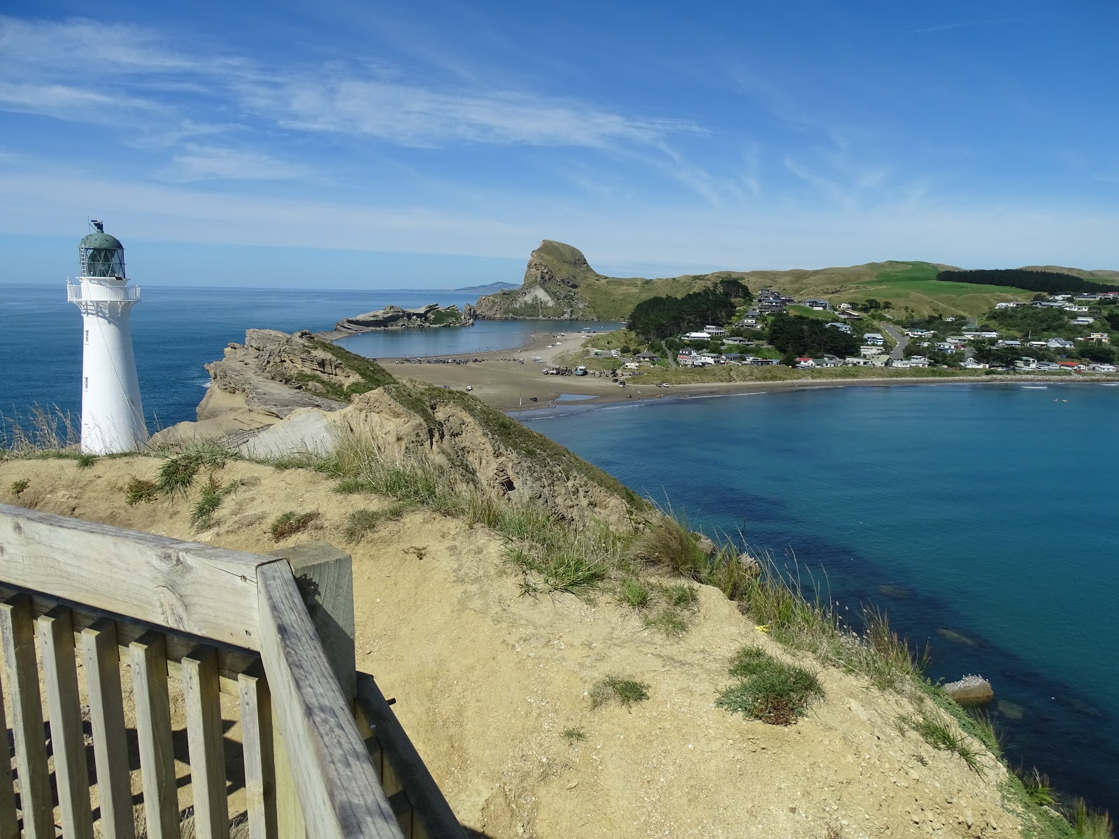
A view of the surf beach from the path to the lighthouse

And both beaches looking back from beyond the lighthouse. The surf beach is to the right and the lagoon is in the distance. You can probably see the long line of cars parked on the beach just this side of the lagoon. And the vehicles to the right of them are the boats and tractors.

There are lots of rocks to clamber over and plenty of spaces to explore. There were even some people fishing off the rocks on the seaward side of the lagoon.

We walked right up to the lighthouseand beyond. The path is easy to walk up, with plenty of places to stop and rest and enjoy the view along the way. They have informative signs all around the place as welllike the one in the next photo just in front of the seat.


The lighthouse was first lit in 1913. At 23 metres high, Castlepoint is New Zealand's third highest lighthouse.


Castlepoint takes its name from Castle Pointthis impressive 160-metre-high rock bluff at the southern end. The water in the foreground is part of the lagoon. You can see the rock in the distance in some of the earlier photos looking back towards the lagoon.

Castlepoint is the only place you will ever see the rare Castlepoint Daisy (Brachyglottis compactus), and there's also a rare moth that can only be found at Castlepoint. We never saw either, other than in these pictures!

We didn't get to see any seals, dolphins or whales either, all of which have been seen at Castlepoint. However, we did see a couple of stingrays. They were right in close to the rock on the surf side of the path to the lighthouse.

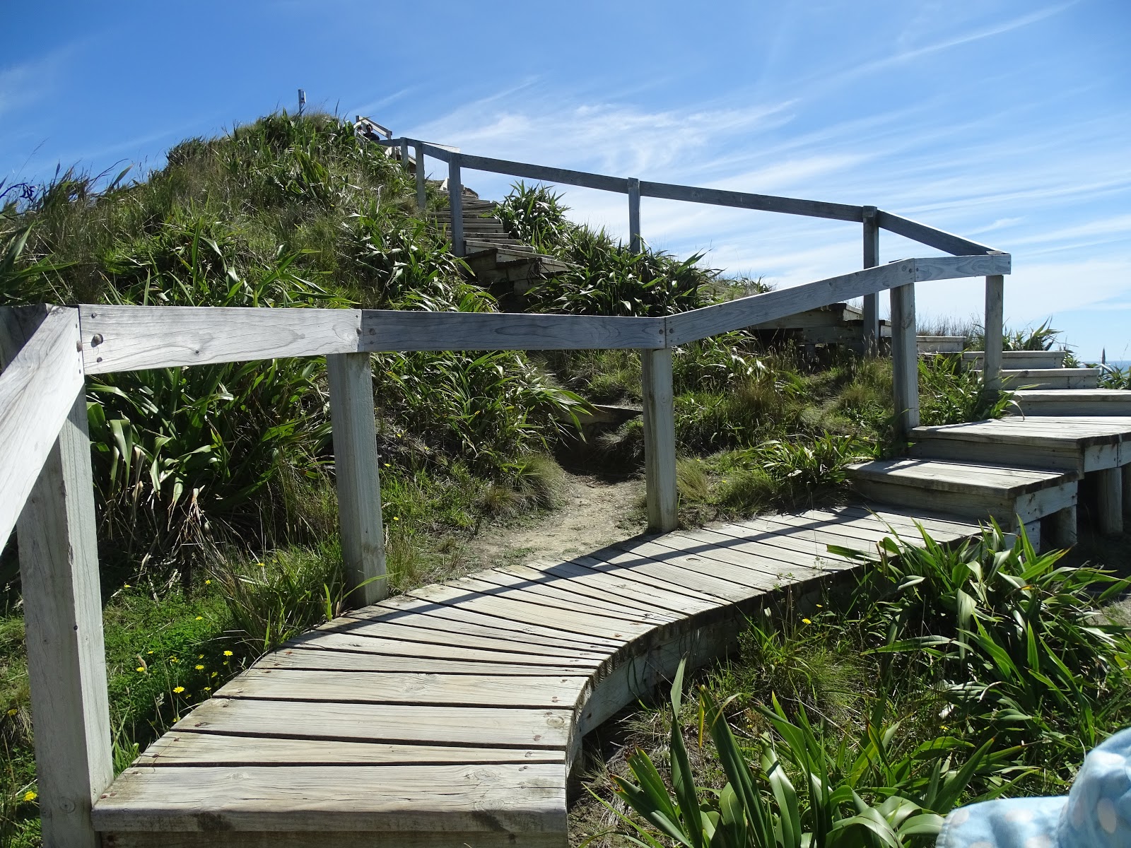
When you get to the lighthouse, you can walk on a little higher. You can see the path up the hill beyond the lighthouse in this next photo. 


The path weaves around to make it an easier climb.

Then as you go down the other side, it's possible to get off the track and walk over the rocks. I only saw one small part roped offyou can walk right to the edge of the rock, and it's a long way down to the water. Perhaps one of the few places left in NZ where they still rely on people having some common sense.


The land and rocks here are interesting. I found this description online that explains it well:
"Castle Point is one of Wairarapa's most spectacular landforms. It is made of successive layers of lime and sandstone, deposited over the last two million years. On the seaward side it sits on an older base of siltstone. As the land rose from the sea, the encircling softer mudstone was eroded, exposing harder limestone. The offshore reef is also limestone. It's elongated shape is due to faults that run either side." https://teara.govt.nz/en/wairarapa-places/page-4

It's interesting to see the shells sticking out of the rock here, far above the sea, indicating that many years ago, all this was under water.

Here's a closer view.

Although the walk to the lighthouse was not a difficult one, it was a hot day, so we treated ourselves to an ice cream from the local store across from the beach. Look at all those seagulls lined up on the roof!

I noticed this man in front of where we parked, sitting under a tree with his book. What a perfect place to relax!

If you cannot see "Post a Comment" below, click here (and scroll down to the bottom of the post) to talk to me!