Pages

Saturday 31 March 2018

Coffee in Queenstown


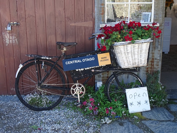
We'd both been to Queenstown before but being so close, we couldn't skip the opportunity to check it out again. Queenstown is arguably the most popular NZ destination place for tourists. Naturally, it's a busy place with tourists (yes, just like us) everywhere. We decided to park up and go for a walk to find a coffee.

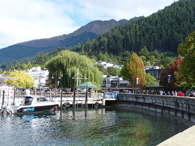
The waterfront (Lake Wakatipu) dominates Queenstown, and is just beautiful. The water is clear and the trees give it a natural peaceful ambience.


Parachutes colour the skies above Queenstown. Gondolas will carry you up to this pointyou'll get excellent views from up here.

In the lake I spotted some of these. The NZ native scaup, aka black teal/ papango.


More images of Queenstown include buskers (one of them with an accompanying canine tenor), shops and, of course, more people.


We eventually found a place to sit and watch the world go by. We ordered coffees and sat to wait. They took so long, we were concerned that our parking metre was going to run out. On our last trip to Queenstown we ended up with a parking ticket and weren't keen to repeat the experience. So Dave went back in to change our order to "coffees to go". It appears they'd had a mini disaster inside with coffees dropped and spilt all over the floor, hence the delay. Ours were ready, but we took them as takeaways anyway. We drank them quickly and headed back to the carthere was no ticket! :)


If you cannot see "Post a Comment" below, click here (and scroll down to the bottom of the post) to talk to me! 

Friday 30 March 2018

Kawarau Gorge


The Kawarau River runs along the highway between Cromwell to Queenstown. Near the Cromwell end is the Kawarau Gorge.

As I grew up in the Bay of Plenty (North Island), I keep wanting to spell it Kawerau. But no, that's another place, and this is definitely "Kawarau River/Gorge" spelt with an "a"!

This area has a history of gold miningas you're travelling through the gorge, there's a place you can stop and visit an old gold mining site. There's this pulley thing that goes across the river. I'm not sure what it's for, but I don't think I'd trust it to get ME safely from one side to the other!

This is also the place where the Goldfields Jet picks up passengers.

A little further down the road we pulled over and noticed, on the other side of the river, some little huts. They're smack bang in the middle of the picture. These, apparently, are miners huts. there is a closer view in the following two photos.


And further along, another hut.

Travelling towards Queenstown, we came across Roaring Meg. That's the name of the river that feeds into this power station and then the Kawarau River. Apparently, the gold miners named this "turbulent stream" Roaring Meg after a noisy red-headed Irish barmaid, Maggie Brennan. As the story goes, an early party of diggers took two girls with them from a dancing saloon. When they reached the first large stream, they carried the girls across. The first one, Maggie, made such a fuss that they named it after her (Roaring Meg) whereas the other girl was calm and placid and so they named the next stream after her (Gentle Annie).

Another notable place to visit along the Kawarau River is the Kawarau Bridge Bungy. Dave did this on our last trip down this way, some years ago. Not something we needed to repeat. I think it must have been on his bucket listdefinitely not mine! This photo was taken from across the other side of the gorge.

Some more photos of the Kawarau River taken from the road in to Chard Farm Vineyard.


If you cannot see "Post a Comment" below, click here (and scroll down to the bottom of the post) to talk to me! 

Thursday 29 March 2018

Cromwell Heritage Precinct


Cromwell is a town in Central Otago situated on the southern edge of Lake Dunstan where the Clutha and the Kawarau Rivers meet. In 1862, gold was discovered in this area and Cromwell, then called The Junction, developed as a result of this. Today it is more well known for the fruit the area produces, such as apricots, nectarines and peaches.

On the shore of the lake in Cromwell is the Cromwell Heritage Precinct. This area has been set aside as a reminder of the past. Many old buildings have been retained as original. Within them, some have been treated as a museum, with models, machinery and items dating back to the 1800s, whereas other buildings are now art and craft shops, cafes, offices, etc. The exterior of the shops have retained their original facadewhat is inside, however, differs.

This board near the entrance shows a map of the area and lists the old name of each building beside the name of the business it now houses.

Entering the precinct. There is no charge to look around. This building, once a bakery, is now an art gallery.

Wisharts Blacksmith


Lake Dunstan is a man-made lake formed by the construction of the Clyde Dam. Parts of the town of Cromwell were relocated before they flooded the area in 1992 - 93.

This picture shows what the Athenaeum Hall once looked like. You can see it's now partially buried, with the two pictures at bottom right showing the tops of window frames at the level of the road.


The office of the Cromwell Argus (local paper), with a scary looking man behind the desk.

There were old printing machines . . .

. . . and even old telephone exchange boards!

A beautiful old barn . . .

. . . with this amazing stone floor.

Many of the buildings were made of stone. The floors in this stable were also stone. They weren't very easy to walk on. I imagine it would have been slippery for the horses too.


 The old Post & Telegraph Office now houses a modern set of offices.

Leaving the precinct, as we drove down the road, we came across this beautiful old churchThe Stone Temple. The signs tells how it was formerly known as St Johns Presbyterian Church and was built between 1880 and 1881. In 2004 it was sold to new owners who restored it to a modern home. It's now available as boutique accommodation and also used as a wedding and event venue


At The Junction Lookout further down the road, there are views of where the rivers meet. There's an excellent sign pointing out all the landmarks.

And immediately across the lake lie rugged hills.


If you cannot see "Post a Comment" below, click here (and scroll down to the bottom of the post) to talk to me!